-
Jammu Kashmir
Jammu
Kashmir
Ladakh
When we say, “We can make a World of Difference” here’s why?
We love to serve you. -
JK Tours
Kashmir
"You can leave Kashmir, but it will never leave you."
Come See Kashmir -
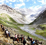
Adventure
Pilgrimage
Sightseeing
"You can't understand a Kashmir without staying with us."
Lets Travel Kashmir -
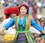
Art and Culture
Landscape
Architecture
Events and Festivals
"Gar firdaus baruhe zamin ast Hamin asto, hamin asto, hamin asto"
(If there is a paradise on earth, it is here, it is here, it is here.) -
Before you Go
When to Go
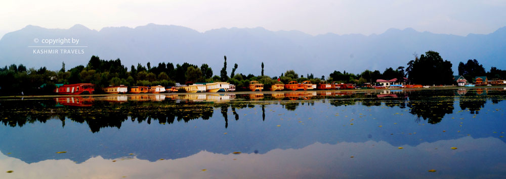
Accomodation
We arrange your stay in top luxurious hotels and houseboats. During your stay you are our guests and it is our duty to make you feel home in Kashmir.
Get a quote | make a booking
It’s easy to get a quote or book a Tour with Us.
Kashmir Travels often has some great deals and you can view these by clicking.
EXHILERATING VIEWS
Enjoy breathtaking views, unmatched anywhere else in the world. Our hotels and houseboats are located on some of the most pristine locations of Kashmir.
Traveler's Guide
With the Kashmir travels scheme you can get exclusive rates, or join us as an affiliate to earn commission on all referrals.
Travel Needs
Just leave the details to us! Our reliable and well trained travel consultant will be waiting to escort you. We arrange your stay in top luxurious hotels and houseboats.
Traveler's Guide
When we say, “We can make a World of Difference” here’s why? We love to serve you.Kashmir Travels is a family-owned business that was founded in 1960s.
Group Tours
We will go the extra mile to facilitate your booking. Whether you have a sports team, school group, band, orchestra, family.
Excellent 24/7 customer service
Kashmir Travels is a special team dedicated to catering to the travel needs we can source excellent group rates, for Treks, Ski, Tours.
Tour Packages
No need to surf Multiple Sites for packages, quotes, travel plans! Simply fill the booking form and Get up to 4 quotes in your MAILBOX.
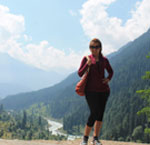
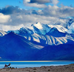
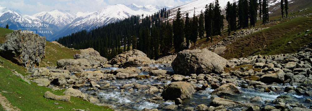
Hills and Mountains
MOUNTAINS, HILLS AND MOUNTAIN PASSES IN JAMMU, KASHMIR AND LADAKH
“The mountains were his masters. They rimmed in life. They were the cup of reality, beyond growth, beyond struggle and death. They were his absolute unity in the midst of eternal change.” ...
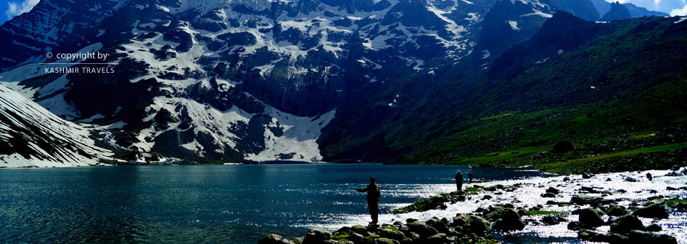
As William Blake quotes" Great things are done when men and mountains meet; This is not done by jostling in the street"; mountains truly are amazing physical creations which are a source of recreation and unequivocally lure us into the freedom of wilderness. The changing colours of mountain ranges at different hours of the day in Kashmir is definitely leave indelible traces. One of the main attractions of Jammu Kashmir State is the majestic mountains and the green hills that surround it and harbour it in its lap. Jammu Kashmir is particularly known for the circumambient mighty ranges. The four important mountaineering zones in the UT of Jammu and Kashmir are Kashmir, Zanskar, Kishtwar and Ladakh.
The mountains in Kashmir are categorised as Alpine and Himalayan. Some of the world’s highest peaks are located in the union territory which apart from being a breath of fresh air provide tremendous, exciting and challenging opportunities for trekking, hiking, mountaineering, rock climbing and much more.
Most of the tourist resorts of the union territory are located on green hills.Nowadays, the hills have been made accessible by well-polished roads and the tourist infrastructure in most of these hilly areas is convenient. The mighty Himalayan ranges in Jammu, Kashmir and Ladakh have plenty of colossal lofty peaks that are ultimate favourite destinations of everyone for trekking and other mountain expeditions and challenges.
For trekking and rock climbing the mountains in Ladakh in particular are the best. World’s second and the fifth highest mountains are accessible from Ladakh. Nun Kun massif, Zanskar range and the Karakoram Range are the primary peak ranges in this region. However, due to the hostile climate, if you want to explore the peaks of Ladakh, choose the summer months for the expeditions. Kashmir valley is surrounded by lofty mountain ranges from all sides excluding certain passes and a narrow gorge at Baramulla. Apart from hills and mountains, there are volcanic mountains too in the union territory. The mountains of Kashmir have something unique to them which is acknowledged by Sir Walter Lawrence in the following lines:
"It would be difficult to describe the colours which are seen on the Kashmir mountains. In early morning they are often a delicate semi-transparent violet relieved against a saffron sky, and with light vapour clinging round their crests. Then the rising sun deepens the shadows, and produces sharp outlines and strong passages of purple and indigo in the deep ravines.
Later on it is nearly all blue and lavender, with white snow peaks and ridges under a vertical sun, and as the afternoon wears on these become richer violet and pale bronze, gradually. changing to rose and pink with yellow or orange snow, till the last rays of the sun have gone, leaving the mountains dyed a ruddy crimson with the snows showing a pale creamy green by contrast"
The most famous peaks of Kashmir include the Kolahoi which is also known as the Matterhorn of Kashmir, Harmukh, Tattakuti, Sunset which is the highest Peak in the Pir Panjal Range and some other peaks of Gulmarg, Sonamarg and Pahalgam.
The peaks in the Kishtwar region, though not high, offer technically difficult climbing owing to some ridges. There are virgin peaks too.Mountains of this region include Crooked Finger, Sickle Moon , Riger , Brammah-I ,, Arjuna, Katori and Flat Top . The most well-known peaks of the Zanskar Range are Nun-Kun, White Needle, Pinnacle, Z-1, Z-2, Z-3, Z-8, D-41, N-8, Bien Guapa, Bobang, etc.
Mountain and mountain passes like Stok Kangri, Mamostang Kangri, Parcha Kangri, Kang Yatze,Pensi La Ladakh comprise the Ladakh range.The popular peaks of Ladakh and Kashmir where mountaineering expeditions are organized on a regular basis are Apsarasas, Chong Kumdan, Teram Kangri Group, Tughmo Zarpo and Saser Kangri. Places like Pahalgam, Gulmarg and Sonamarg serve as base camps for trekking tours to mountain peaks.
45 FAMOUS MOUNTAINS, HILLS AND PASSES OF JAMMU, KASHMIR AND LADAKH
1.AMARNATH PEAK:
At an elevation of 5,186 metres above sea level, located in Ganderbal district ,Amarnath Peak is part of the Himalayas, and is located south of Zojila and west of Machoi Glacier. It is considered sacred, since the cave at its south face at an elevation of 3,800 metres is believed to be the site where Shiva revealed his secret of immortality to his consort, Parvati.The peak also stands unclimbed, due to its sacredness.
Amarnath Peak was first surveyed by a British medical team headed by Dr Ernest Neve in 1912, who also surveyed most of the peaks of this Himalayan range. Later, in 1933, a Scottish Colonel N. N. L. Watts discovered an easy route to scale the peak.
2.APHARWAT PEAK: Stationed in Gulmarg at a height of 4,390 metres above the sea level,
It ranks as one of the Asia's highest gondola ski-lifts. The ropeway connects Kongdoori valley with the mountain. Afarwat is famous for winter sports such as snowboarding. You can also visit Alpather Lake, which usually remains frozen till June. The Lake lies across the Apharwat peak. The famous Alpather lake lies on this peak, which gives rise to Nullah Nagal and flows down into the Wular lake.The lake remains frozen from November to June since
it receives heavy snowfall and remains covered with snow for much of the year. The Line of Control (LOC) is barely a few kilometres away from here.
3.BRAMMAH: A mountain massif in the Kishtwar Himalayas of Jammu and Kashmir, comprises four peaks, Brammah I, Flat Top , Brammah II and Arjuna.(west to east).Brammah II is the highest whereas Brammah I the most dramatic.The mountain was first ascended in 1973 by British mountaineer Chris Bonington, along with Nick Estcourt, and aided by the Indian Institute of Skiing and Mountaineering.
4.THE EASTERN PINNACLE PEAK:
Lying at an elevation of 4760 m above sea level, the Eastern Pinnacle Peak is stationed in the middle of the cluster of peaks around Thajiwas Area of Sonamarg. Valehead Peak and Umbrella Peak are near to it. It was first ascended in 1945 by a famous English mountaineer and explorer, J.A. Jackson.
It was not ascended again till 12 July 2020 when a group of Kashmiri mountaineers belonging to Cliffhangers India summited it.The group was led by Mohammed Arif, the founder of Cliffhangers India, Junaid Ahmed, Nazir Raina and Nazir Jr.
5.GURUNG HILL:
It is stationed near the Line of Actual Control between the Indian- and Chinese-administered regions of Ladakh near the village of Chushul and the Spanggur Lake.
6.KHARDUNG LA PASS:
Khardung La or Khardung Pass( la means pass in Tibetan) is a high mountain pass located in the Ladakh region. It is stationed to the north of Leh and is the gateway to the Shyok and Nubra valleys. It is claimed that it is the world's highest motorable pass being at an elevation of 5602 m however these claims are disputed. The 5,359 m elevation measure was taken from a modern GPS survey by a team of researchers. It is maintained by the Border Roads Organisation and carries a strategic importance to India as it is used to carry supplies to the Siachen Glacier. It is also historically important as it lies on the major caravan route from Leh to Kashgar in Central Asia. During World War II there even has been an attempt to transfer war material to China through this route.
7.HARMUKH:
The word "Harmukh" is derived from the word Haramukuta, which means "the diadem of Hara (Shiva)." It is also known as 'Kailash of Kashmir.' Lying at an elevation of 5,142 metres, in Ganderbal district of Jammu and Kashmir, this Himalayan Range lies along the southern edge of the Eurasian tectonic plate and is made up of more than 390 million years old sedimentary rocks. Harmukh lies in the north-western Himalayan range and is located between Nallah Sindh in the south and Neelum River in the north and Gangabal lake lies at its foot. The Karakoram Range borders it on the north and the Kashmir valley on the south. The peak is considered sacred by Hindus since it is believed it was the abode of Lord Shiva. The entire region of Harmukh is also known as Ramaradhan, as it is believed that Parashurama had meditated on this mountain range. According to the legend of "Hurmukhuk Gosoni", a hermit who tried to reach the summit of Harmukh to see Shiva failed for twelve long years until the day he saw a tribal man descending the summit.
Upon enquiring if the tribal man had seen Shiva, he responded that he had been looking for a stray goat, during which he saw a couple milking a cow and drinking the same from a human skull. The couple had offered him some milk too, to which he refused ;before setting off to go, they rubbed some milk on his forehead. When the Gujar mentioned the spot where the milk was rubbed, the hermit became ecstatic and rushed to lick his forehead. This mountain massif has several summits, the Station Peak being the lowest which was first climbed by members of the Great Trigonometric Survey of British India led by Thomas Montgomerie in 1856.
8.KAZINAG PEAK:
Lying at an elevation of 4,574 m above sea level, located in the Districts Baramulla to Kupwara, it forms part of the Line of Control.
The historic Kazinag spring, Satkhol Nag and Kazinag Glacier are stationed on the top.It is also abode to Markhor, an endangered species of mountain goat.
9.KOLAHOI PEAK:
It is also called 'Gashe-braer' which means 'the goddess of light.'. Lying at an elevation of 5,425 m in Anantnag district, it is the highest mountain in Kashmir Division. The peak has an easy access through Aru valley and lies in the vicinity of Sonamarg . Rising from the Kolahoi Glacier, Sindh flows to its north while the Lidder River from the south. In 1912, Kolahoi Peak was first climbed by a British medical team headed by Dr Ernest Neve. It is the main source of Lidder River, whose water serves the population of Anantnag district. Nowadays,
Kolahoi Glacier is among the victims of global warming.
10.MECHOI PEAK:
Lying at an elevation of 5,393 metres), in Drass region of Ladakh,Mechoi Peak comprises of the Himalayan Range, and is located between Amarnath cave and Zojila. It rises from the Mechoi Glacier and is the source of Dras River in Drass, Ladadkh.It was first surveyed by a British medical team headed by Dr Ernest Neve in 1912. Later, on September 10, 1984 it was climbed by a team of the Indian Army.
11.MAHADEV PEAK:
Located at an elevation of 3966 m, the peak comprises the Zabarwan Range. It is located in Srinagar and visible in almost every part of the city. Tarsar & Marsar lakes lie on the eastern side of this mountain. It is the highest peak of the Zabarwan range and also the highest in Srinagar. It is close to Dachigam National Park and as a consequence of which region is rich in flora and fauna.
12.SADHNA PASS:
Itvwas previously called Nastachun pass.
At an elevation of about 3000 m above sea level, it is a mountain pass located in the Himalayas in the vast Shams Bri mountain range of Tangdhar in Kupwara district. The pass is best known for its mythological legend of Blind and Deaf Fairies.
13.SICKLE MOON PEAK OR BHARANZAR PEAK:
At an elevation of 6,574 metres above sea level, the peak is located in the Kishtwar Himalaya and is the highest summit of the range.
14.SUNSET PEAK:
It is also known as Romesh Thong. Lying at an elevation of 4,745 m, on the border of the Poonch and Shopian districts of Jammu and Kashmir. It is the highest peak of this massif, the other peak being Tatakooti Peak . It is named so as it lies to the west of the Kashmir valley.
15.SIRBAL PEAK:
Stationed at an elevation of 5,235 m in the Ganderbal district of the Indian union territory of Jammu and Kashmir,Sirbal Peak comprises the Himalayan Range. It rises from a glacier 5 km ahead from Sonamarg whose waters the add to the flow of Nallah Sindh. Sirbal Peak comprises a list of unclimbed peaks. It was first surveyed by a British medical team headed by Dr Ernest Neve in 1912, who surveyed most of the peaks of this Himalayan range.
16.BILAFOND LA:
In Balti language the name "Bilafond La" means "Pass of the Butterflies".It is also known as the Saltoro Pass, since it is situated on Saltoro Ridge, sitting immediately west of the vast Siachen Glacier.
17.TATAKOOTI PEAK:
Lying at an elevation of 4,765 m in Poonch district of Jammu and Kashmir, it is the highest peak of this district.It is located 40 km west of Shopian town and 105 km southwest of Srinagar.The first ascent of the summit was made in 1901 by British mountaineers, C. E. Barton and Dr Ernest Neve.This is still a virgin peak with crystal clear waters and the alpine lakes viz. Sukhsar, Neelsar, Bhagsar, Katorasar and Kaldachnisar.
18.KARAKORAM AND KUNLUN RANGES:
Karakoram is a Turkic term meaning black gravel and in traditional Indian geography the mountains were known as Krishnagiri (black mountains) whereas Kunlun is originally the name of a mythical mountain believed to be a Taoist paradise.
Both these mountains lie to the north and north-east of the State and separate it from Russia, Turkistan and Tibet. The highest peak of Karokaram (and world's second highest), K2, is located in Gilgit-Baltistan. The Karakoram has eighteen summits over 7,500 m in height, with four exceeding 8,000 m;K2, Gasherbrum I, Broad Peak and Gasherbrum II. On the other hand, Kunlun range constitutes one of the longest mountain chains in Asia. The main feature of this range is Kunlun Volcanic Group, a series of about 70 volcanic cones scattered along its entire length, which are a result of the various accumulations of emissions from the volcanic vents around the craters
19.ZANSKAR RANGE:
An etymological study of the name reveals the name can be derived from Tibetan words Zangs which means copper owing to the natural occurrence of copper in this region and the second syllable of the name is said to connote different meanings: "Zangs-dkar" (white copper), "Zangs-mkhar" (copper palace), or "Zangs-skar" (copper star) and copper valley and even food valley is claimed to be one of the interpretations.Lying at an elevation of 6000 m, it lies in Ladakh and is a part of Tethys Himalaya.The Zanskar Range spreads over a vast area from south-eastern boundaries of Kashmir and extends to the eastern limits of Baltistan in the north-western direction, serving as a boundary line between Ladakh and J&K. The 7,000 m high peak Nun Kun comes within this range and the 4,000 m high Zojila Pass is also in the extreme northwest of Zanskar range.
20. NUN AND KUN PEAKS:
After partition and various wars, the highest point in the union territory are the two icy pyramids, Nun (7135 m) and Kun (7077 m) massif lying in the Zanskar Range, with Nunbeing the higher of the two peaks, and the highest mountain in Jammu and Kashmir. It lies between Ladakh and Kashmir border. The massif is located near the Suru Valley, about 250 km east of Srinagar.
Early exploration of the massif included a visit in 1898 and three visits by Arthur Neve, in 1902, 1904, and 1910. In 1903, Dutch mountaineer Dr. H. Sillem investigated the massif and discovered the high plateau between the peaks.The first ascent of Nun was took place in 1953 by a French-Swiss-Indian-Sherpa team led by Bernard Pierre and Pierre Vittoz whereas the first ascent of Kun was made in 1913 by an Italian mountaineer Mario Piacenza.
21.NANGA PARBAT RANGE:
The name Nanga Parbat is derived from the Sanskrit words nagna parvata, meaning “naked mountain.” It is also called Diamir which means “king of the mountains.”It is one of the tallest mountains in the world lying at an elevation of 8126 m above sea level. Bereft of the vegetation, it is situated in the western Himalayas.
The British Alpine climber Albert F. Mummery was the first to attempt to scale the peak in 1895 but died in the attempt followed by at least 30 more climbers (mostly German-led) who also perished on Nanga Parbat because of the severe weather conditions and frequent avalanches. It was in 1953 that the Austrian climber Hermann Buhl reached its summit successfully.
22.BURZIL PASS:
Lying at an elevation of 4100 m above sea level, it bifurcates Kashmir and Ladakh .It is an ancient pass and caravan route between Srinagar in Kashmir and Gilgit. The route had been active up to Pakistan's independence. The Astor river originates from western slopes of the pass. The travellers used horses and ponies to cross the pass.
23.TOSHMAIDAN RANGE:
Lying at an elevation of 4270 m, the mountain range comprises of Toshmaidan and Kajinag ranges and lies in the Inner Himalayas.It remains snow-clad throughout the year, and during summers the water from the melted snow flows down into the Jhelum river. On the top of it, stands the historical Kajinag spring and Satkohl Nag which have been supplying water to the areas of Kehmil, Puhru, Mawar and Talar rivers and some of the water is going to Pakistan thru Nowkote.
24.PIRPANJAL RANGE:
The Pir Panjal Range lies inside the Inner Himalayan region, with the average elevation varying from 1,400 m to 4,100 m . It is the largest range of the lower Himalayas stationed close to the bank of the Sutlej River. It separates Kashmir valley from the outer Himalayas. Famous Banihal pass and Gulmarg lie in this range. Now a new tunnel 'Jawahar Tunnel' with a height of 2200m has been constructed here. Baramulla pass and Hajipir pass also lie on the other side of the range.
25.SHIIVALIK RANGE:
It was known as Manak Parbat in ancient times. The word "Shivalik" literally means 'tresses of Shiva'. At a varying elevation of 600 m to 1500 m above sea level, these hills are the southernmost and geologically youngest mountain chain of the Himalayas. The Siwaliks have various sub-ranges. They extend west from Arunachal Pradesh through Bhutan to Sikkim, and further westward through Nepal and Uttarakhand, continuing into Himachal Pradesh and Jammu and Kashmir.
26.VOLCANIC MOUNTAINS:
A volcanic peak, 'Soyamji' lying at an elevation of 1860 m is situated in North Machhipura (Handwara) . It continuously erupted lava for thirteen months back in 1934. A temple is stationed on this peak and various sulphur springs are found at the foot of the hill. These volcanic mountains are the cause of earthquakes in Kashmir. One more peak called 'Kharewa’ lying in Tehsil Pahalgam, is dead so far. So far twelve devastating earthquakes have occurred in the valley of Kashmir of which one in 1885 was the most devastating.
27.PANGONG RANGE:
Lying in the Ladakh region, it runs parallel to the Ladakh Range about 100 km northwest from Chushul, along the southern shore of the Pangong Lake. Its highest range is 6,700 m.
28.ZOJI LA PASS:
As per some souces, Zoji La means the "mountain pass of blizzards". An oral tradition claims thst Zoji refers to Du-Zhi-la, the goddess of Tibet’s four seasons.
Lying at an elevation of 3528 m, Zoji La is and is the second highest pass after Fotu La on the Srinagar-Leh National Highway. It is a seminal link between Ladakh and the Kashmir Valley. It It often remains inaccessible during winter, though the Border Roads Organisation (BRO) is working to extend traffic to most parts of the year.
The Beacon Force unit of the BRO is responsible for clearing and maintenance of the road during Winter. During the Indo-Pakistani War of 1947, Zoji La was seized by Pakistani raiders in 1948 in their campaign to capture Ladakh. The pass was recaptured by Indian forces on 1 November of the same year.
29.HARI PARBAT (KOH E MARAN):
A hill overlooking Srinagar lies on the west side of Dal Lake in Srinagar. It is the site of a Durrani fort, built in 1808 though the first fortifications of the site had been constructed by Mughal Emperor, Shah Jahan. The hill stations Sharika Temple on the western Slope and Muslim shrines of Khwaja Makhdoom Sahib and Akhund Mullah Shah on the southern slope. On the southern side of the outer wall there is a Gurudwara, which commemorates the visit of Guru Hargobind.
According to mythology, it is also believed that once the hill used to be a huge lake inhabited by the demon Jalobhava to which the inhabitants called on the goddess Parvati for help who took the form of a bird and dropped a pebble on the demon's head, which grew larger and larger until it crushed the demon.Another version of the myth says that two demons, Tsand and Mond, occupied the valley. It is said that Tsand hid in the water near the present location of Koh e Maran and Mond somewhere above the present Dal Gate.
Both terrorized the people of the valley to which gods invoked Parvati who assumed the form of a Haer (a type of bird) and flew to Sumer, picked up a pebble and threw it on the demon Tsand to crush him. The pebble transmogrified into a mountain. That is why Parvati is worshipped as Sharika in the Sharika Temple located in the middle part of the western slope of the hill.
30.LADAKH RANGE:
The Ladakh Range is a part of the Karakoram mountain range, that extends from the
mouth of the Shyok River in the Ladakh region to the Tibetan border. The southern extension of the Ladakh Range is called the Kailash Range, in Tibet.
It has an average height of 6000 m and has no major peaks.The main mountain passes are Chorbat, Digar La Khardung La, Chang La and Tsaka La.
31.STOK KANGRI:
Lying at an elevation of 6,153 m, it is the highest mountain in the Stok Range of the Himalayas in the Ladakh region. The peak is located in Hemis National Park.Despite its high altitude, Stok Kangri is a popular peak for mountaineering.
It is higher than the highest mountain in Europe, Mt. Elbrus although marginally, but even higher than the highest mountain in Africa, Mt. Kilimanjaro. This way,it beats two highest mountains. The peak has been judged safe enough to climb for teams by expedition companies.
32.MAMOSTONG KANGRI:
The mountain was named by Yarkandi traders. In the Turki dialect, Mamo means 'fog' and Stong 'thousand.'Mamostong Kangri or Mamostang Kangri is the highest peak in the remote Rimo Muztagh, a subrange of the Karakoram range in India near its border with China. It reigns at a lofty altitude of 7516 m which makes it the 48th highest independent peak in the World (using a 500m prominence cut-off). The South Chong Kumdan Glacier, Kichik Kumdan (Thangman), Mamostong, and South Terong Glaciers all head on the slopes of Mamostong Kangri. The area is a complex maze of rugged peaks and broken glaciers.
The peak has five prominent ridges.
As per the legend of its naming, it is said that a group of traders who were looking for an alternate route to the Saser la, crossed over from a col at the head of the valley, into the Thangaman glacier. However, they were never seen again, as the whole party perished in the shadow of the mountain.
The mountain, which was perpetually enveloped by fog and mist, was thus named 'Mamostong'. The first European exploration of the peak was made in 1907 by Arthur Neve and D. G. Oliver. The mountain system was surveyed in 1913-14 by Sir Filippo de Filippi's expedition and the first ascent was made in 1984 by an Indo-Japanese expedition, led by Colonel Balwant Sandhu and Yoshio Ogata.
33.MAGNETIC HILL:
Lying at a distance of around 30 km from Leh, Magnetic Hill lies on the Leh-Kargil-Srinagar National Highway in the Trans-Himalayan region. Sindhu River flows to the east of the Magnetic Hill. It is a gravity hill which means it defies gravity. Actually, the layout of the area and surrounding slopes create the optical illusion of a hill.
34.KONGKA LA:
In Ladakhi language, Kongka means a "low pass or ridge, high point or rise of a plateau" And a Tibetian version of the name claims it means "wintertime pass." Lying at an elevation of 5,171 m, it is a high mountain pass of the Chang-Chemno Range on the Line of Actual Control. China considers the Kongka Pass as its border. In October 1959, Indian troops crossed the Kongka Pass in an attempt to establish posts on the Lanak Pass.
The party was led by an Intelligence Bureau officer of the rank of Deputy Superindent, Karam Singh, who was an experienced patroller in Ladakh.
This resulted in a clash with the Chinese soldiers posted on Kongka Pass. Of the 70 Indian soldiers, nine were killed and ten were taken prisoners whereas Chinese soldiers reportedly suffered one death. Indian media described the event a "brutal massacre of an Indian policy party." The incident contributed to tensions between the two countries and preceded the Sino-Indian War in 1962.
35.BANIHAL PASS:
The word Banihal means 'blizzard.'
At a maximum elevation of 2832 m, the Banihal Pass across the Pir Panjal range separates the Kashmir valley from the outer Himalayas and plains to the south. Banihal pass remains covered by snow during the winter. Here, one can witness a sharp change in nature and mountains.
It is the gateway which connects Jammu and Srinagar made possible by the 2.5 km long Jawahar tunnel and now the Banihal-Qazigund rail tunnel [India's longest and the third longest in Asia]. Another four lined tunnel is under-construction. According to “Rajtarangni” -a chronicle penned by Kashmiri historian Kalhana , Banihal was known as ‘Vishalta’ in the 11th century.
36.MUNAWAR PASS:
It comprises the Pir Panjal range of Kashmir.
and lies in the north of Pir ki Gali. The pass witnessed terrible fighting during Operation Gibraltar and was held by Pakistani Force commanded by Major Malik Munawar Khan Awan SJ on whose name the pass entitled by locals.
37.ROHTANG LA:
The name Rohtang means ‘ground of corpses’ due to the number of people who lost their lives trying to cross it.Stationed at an altitude of 3,978 m, Rohtang La is a mountain pass on the eastern Pir Panjal range connecting Manali in the Kullu Valley to Keylong in the Lahaul Valley. Rohtang Pass holds strategic importance for India. The Pass offers mesmerizing vistas of glaciers, peaks, Lahaul Valley and the Chandra River. The twin peaks of Geypan are also visible from Rohtang. The pass is on the watershed between the water basins of the Chenab River and the Beas River.
38.HAJI PIR PASS:
Lying at an altitude of Haji Pir Pass 2,637 m on the western Pir Panjal range in the Himalayan region, it is located on the road between Poonch and Uri is in the area of Kashmir administered by Pakistan. The pass, and therefore the strategically significant road, was taken from the control of Pakistani forces and others connected to that country by the Indian Army in 1947.The Haji Pir Pass provides an easy access to both Jammu and Kashmir regions.
39.MOUNT KOTWAL OR THE GUARDIAN:
Stationed at an elevation of 14,211 feet, the peak lies to the right of Naranag Kangan and is visible from Srinagar. The peak was scaled recently by Alpine Adventurers on 30th of July
40.HABBA KHATOON PEAK:
This gigantic graceful mountain of 13000 feet is pyramid shaped peak in Gurez named after a much revered woman by Kashmiris, Habba Khatoon (also called Zoon) who is often referred as the 'Nightingale of Kashmir'. She is said to have lived near the mountain's base as a young woman. She was the wife of Yusuf Shah Chak, a King of Kashmir, who was captured by Mughal emperor Akbar. After his husband was captured, she began to wander to look for him in the vales. It is in fact said that she still wanders around this mountain here in Gurez Valley, still searching for the one she so deeply loved.
41.KANG YATZE:
Located at an elevation of 6400 m in Ladakh,
Kang Yatze is a mountain located at the end of the Markha valley in the Himalayas in the Ladakh region of northwest India. It is located in the Hemis National Park. The mountain has two main summits, the lower western peak Kang Yatze II, which is easier to climb and more frequently climbed and the higher eastern peak, Kang Yatze I which is the true summit.
42.NANGA SANGO:
Lying at an elevation of 5776 m, it is situated 15 km North of Leh.
43.TIGER HILL:
Tiger Hill or "Point 5062" is a mountain in the Drass-Kargil. It is one of the highest peaks in the area and was the subject of the infamous battle during the 1999 India-Pakistan Kargil War. The hill has a route to Siachen Glacier and connects Srinagar in Kashmir to Leh in Ladakh. The amazing climate of Drass lends its unique charm; since Drass is known as "The Indian Siberia” and is the second coldest inhabited place in the world after Siberia and the coldest place in India with the lowest temperature dropping to as low as -60°C in winters.
44.PENSI LA:
Lying at an elevation of 4,400 m, Pensi-la is a mountain pass in the Ladakh region. It is the gateway to Padum, the only town and administrative centre in Zanskar, Kargil. It connects the Suru Valley region to the Zanskar Valley region.
45.CHANG LA:
The name literally means "Pass towards the South" or "Pass in the South".
Lying at an altitude of 5,360 m in the Ladakh Range, Chang La is a high mountain pass situated between Leh and Shyok River valley. It is the third highest motorable road in the World. The Chang La is on the route to Pangong Lake from Leh.